Das Wichtigste in Kürze:
- Der Flächennutzungsplan (FNP) zeigt, was eine Gemeinde für ihr gesamtes Gebiet vorsieht, nicht nur für ein einzelnes Grundstück
- Er bindet nach §5 und §7 BauGB öffentliche Planungsträger, nicht einzelne Bauherren, und begründet deshalb kein unmittelbares Baurecht
- Der Bebauungsplan (B-Plan) regelt, was auf einer konkreten Fläche heute zulässig ist; der FNP zeigt die Richtung, oft Jahre bevor ein B-Plan existiert
- Die harmonisierte FNP-Ebene von Mapular deckt 8 der 16 Bundesländer an der Quelle ab, offen benannt; die übrigen 8 zeigen wir als Lücke, statt sie zu verschweigen
- Zusammen gelesen trennen die beiden Ebenen, was heute erlaubt ist, von dem, was wahrscheinlich erlaubt wird, und genau diese Trennung braucht eine frühe Standortprüfung
Wer deutsches Gebiet auf künftige Standorte screent, sollte nicht zuerst fragen "was darf ich hier heute bauen", sondern "wo plant diese Gemeinde überhaupt, irgendetwas zuzulassen". Genau das beantwortet die Flächennutzungsplan-Ebene, und das ist eine andere Frage als die, die ein Bebauungsplan beantwortet. Dieser Beitrag legt dar, was jeder der beiden Pläne tatsächlich zeigt, wo die rechtliche Wirkung liegt, und wie sich der FNP als frühen Filter nutzen lässt statt als Dokument, das man Gemeinde für Gemeinde liest.
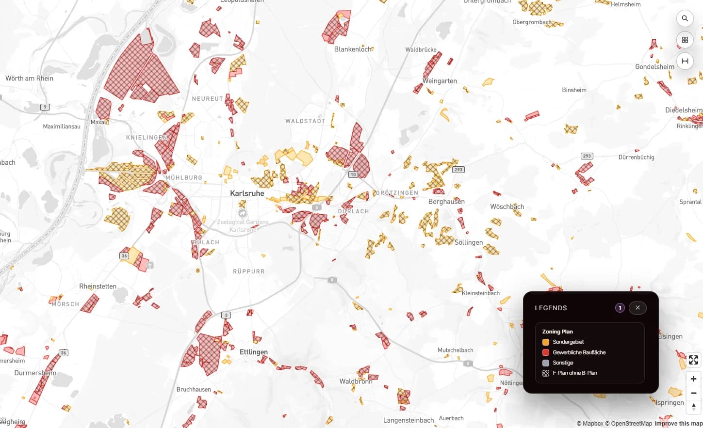
Was ist ein Flächennutzungsplan?
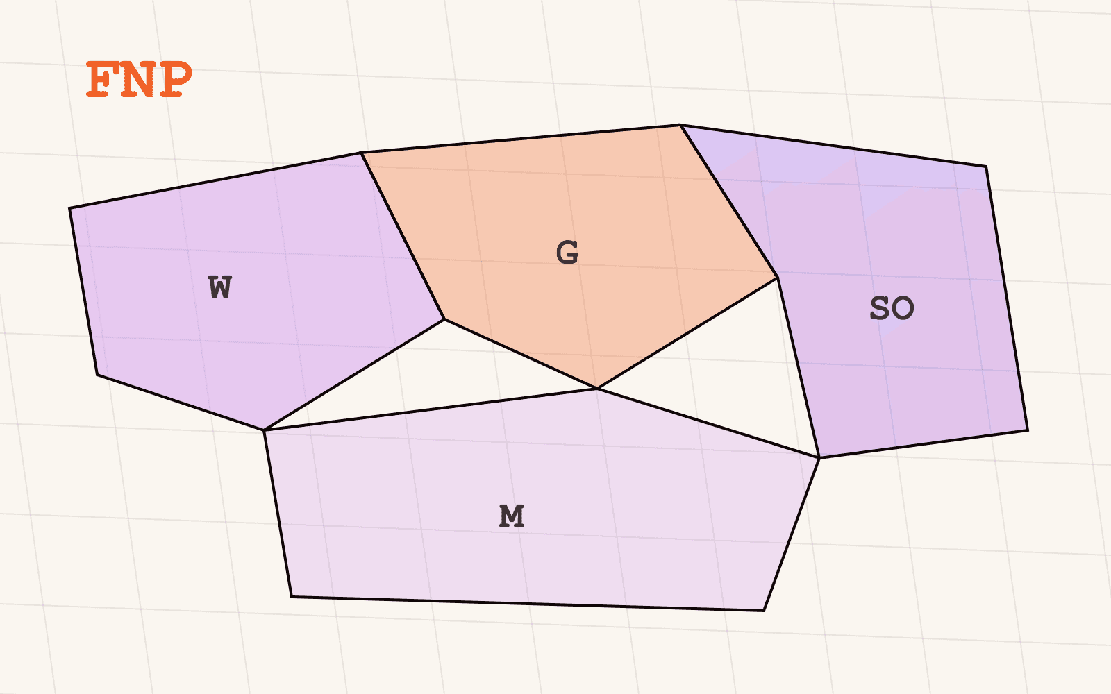
Der Flächennutzungsplan (FNP) ist die vorbereitende, gemeindeweite Ebene der deutschen Bauleitplanung. Während ein Bebauungsplan verbindliche Regeln für eine konkrete Fläche zeichnet, tut der FNP etwas Größeres und Früheres: Er stellt für das gesamte Gemeindegebiet dar, wo Wohnen, Gewerbe, Industrie und Grünflächen in den kommenden Jahren vorgesehen sind.
Man kann ihn sich als die langfristige Absicht der Gemeinde vorstellen, auf eine Karte gezeichnet. Gewerbliche Baufläche, Gemischte Baufläche, Sonderbaufläche (etwa für großflächigen Einzelhandel), Gemeinbedarfsfläche, Grünfläche und Landwirtschaftsfläche erhalten jeweils eine Ausweisung. Nichts davon ist eine Baugenehmigung. Es ist die Gemeinde, die jedem künftigen Planungsschritt, auch ihrem eigenen, mitteilt, wohin sie will.
Genau diese Unterscheidung, vorgesehen für das ganze Gebiet gegenüber verbindlich für eine Fläche, ist der Grund, warum es beide Ebenen getrennt gibt. Wer nur eine davon liest, sieht nur die halbe Lage.
Was zeigt der Flächennutzungsplan, das der Bebauungsplan nicht zeigt?
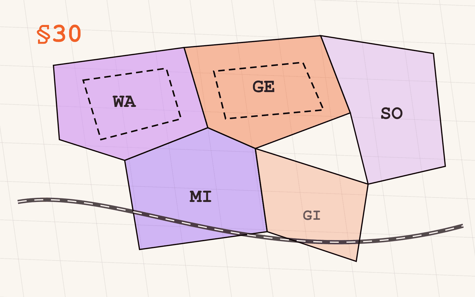
Ein Bebauungsplan ist für die Fläche, die er überplant, rechtsverbindlich. Setzt ein Grundstück ein Gewerbegebiet mit bestimmter Grundflächenzahl und Höhenbegrenzung fest, wissen Sie heute mit hoher Sicherheit, was zulässig ist. Diese Sicherheit ist der Wert des B-Plans, und zugleich seine Grenze: Er existiert nur dort, wo eine Gemeinde das oft mehrjährige Verfahren zur Aufstellung schon durchlaufen hat. Große Teile deutschen Gebiets, auch Flächen, die irgendwann einen B-Plan bekommen werden, haben noch keinen.
Genau hier verdient sich der FNP seinen Platz im Screening, nicht in der Genehmigung. Eine FNP-Ausweisung ist häufig das früheste öffentliche Signal, dass eine Gemeinde grundsätzlich entschieden hat, eine Fläche solle gewerblich oder industriell werden, teils Jahre bevor überhaupt ein Bebauungsplan entworfen wird. Ein Grundstück, das im FNP als Gewerbliche Baufläche ausgewiesen ist, aber noch keinen B-Plan hat, ist heute nicht bebaubar, aber die Gemeinde sagt Ihnen schriftlich, wohin sie will. Ein Grundstück ohne jede FNP-Ausweisung sagt Ihnen ebenfalls etwas: dass eine solche Absicht bislang nicht festgehalten wurde.
Für ein Team, das eine ganze Region auf künftige Logistik- oder Industriestandorte screent, ist das der Unterschied zwischen einer Shortlist, die auf öffentlichem Beleg beruht, und einer, die auf Mutmaßung beruht. Der FNP zeigt Flächenreserven und künftige Gewerbeflächen, bevor sie jemand anders eingepreist hat.
Ist der Flächennutzungsplan rechtsverbindlich?
Nicht so, wie es ein Bebauungsplan ist, und genau an dieser Stelle wird die Ebene am häufigsten missverstanden. Nach §5 BauGB stellt der FNP die vorgesehene Bodennutzung für das gesamte Gemeindegebiet dar. Nach §7 BauGB haben öffentliche Planungsträger ihre eigenen Planungen an ihn anzupassen. Beide Pflichten laufen zwischen Behörden. Keine von ihnen begründet ein Baurecht für einen einzelnen Grundstückseigentümer oder Bauherrn.
Existiert für ein Grundstück kein Bebauungsplan, wird es nach §34 BauGB im Innenbereich beurteilt, also auf Flächen, die bereits von Bestand umgeben sind, oder nach §35 BauGB im Außenbereich, wo Neubauten grundsätzlich restriktiv behandelt werden. Der FNP taucht in dieser Prüfung nicht auf. Er ist nicht das, wogegen eine Baubehörde einen Antrag prüft.
Der Wert des FNP liegt also im Zeitpunkt, nicht in der Gewissheit. Als Frühindikator gelesen zeigt er, wo weiter zu prüfen ist. Als Ersatz für eine Genehmigungsprüfung gelesen führt er in die Irre, denn "im FNP ausgewiesen" und "baurechtlich zulässig" sind zwei völlig unterschiedliche Aussagen. Wer diese Grenze in seinem Workflow klar hält, hat an der Ebene gewonnen; wer sie verwischt, hat für den nächsten Leser der Shortlist eine falsche Sicherheit erzeugt.
Welche Informationen enthalten Flächennutzungsplan-Daten?
Sobald man den FNP als Screening-Ebene behandelt, stellt sich die praktische Frage, was ein Datensatz tatsächlich mitbringt. Die harmonisierte Flächennutzungsplan-Ebene von Mapular normalisiert vier Dinge über alle abgedeckten Gemeinden hinweg:
- Ausweisungskategorie, überführt in ein gemeinsames Kategoriensystem: Gewerbliche Baufläche, Gemischte Baufläche, Sonderbaufläche, Gemeinbedarfsfläche, Grünfläche, Landwirtschaftsfläche und weitere, sodass eine Abfrage in einer Gemeinde genauso funktioniert wie in der nächsten
- Fokus Gewerbe und Industrie, separat gekennzeichnet, sodass eine Standortsuche direkt auf Gewerbe- und Industrieausweisungen filtern kann, ohne sich durch Wohn- und Grünflächen zu arbeiten
- Einzelhandelskonzentration, relevant für Filialnetzplanung und Auswirkungsanalysen, da diese Ausweisungen mitbestimmen, wohin großflächiger Einzelhandel gesteuert werden kann
- Polygongeometrie je Ausweisung, direkt nutzbar für Verschneidungen mit Ihren eigenen Standorten, Einzugsgebieten oder Portfolios
Jede Gemeinde veröffentlicht weiterhin ihren eigenen Plan mit eigener Legende, und genau deshalb bedeutet der Vergleich zweier Regionen normalerweise das Lesen zweier Dokumente. Mapular überführt die lokalen Ausweisungen in dieses eine gemeinsame Kategoriensystem, und aus dem Vergleich wird ein Filter statt einer Leseübung. Wo eine Quelle mehr Detail veröffentlicht, als das gemeinsame Schema verlangt, behalten wir es bei, statt es einzuebnen; was Sie erhalten, folgt der veröffentlichenden Stelle, nicht einer Obergrenze auf unserer Seite.
Führen Sie zusätzlich eine Bebauungsplan-Ebene, nutzen beide dasselbe Geometriemodell und dieselben Identifikatoren, sodass Sie die vorbereitende FNP-Absicht direkt mit den verbindlichen B-Plan-Regeln überlagern können: die Richtung aus dem FNP, die Regeln aus dem B-Plan, in derselben Karte.
Welche Bundesländer veröffentlichen Flächennutzungsplan-Daten?
Nicht alle, und das gehört ebenso offen benannt wie die Abdeckung selbst auf der Ebenen-Seite: Flächennutzungsplan-Daten sind in 8 der 16 Bundesländer an der Quelle veröffentlicht. Baden-Württemberg, Berlin, Brandenburg, Hamburg, Mecklenburg-Vorpommern, Niedersachsen, Schleswig-Holstein und Thüringen veröffentlichen; die übrigen acht tun es nicht.
Wo ein Land veröffentlicht, führt Mapular die Daten, bezogen aus den amtlichen Geoportalen und Planungsdiensten dieser acht Länder, wobei jedes Polygon den Verweis auf die veröffentlichende Stelle behält, sodass sich jeder Datensatz an der Quelle prüfen lässt. Für die acht Länder ohne Veröffentlichung sagen wir das direkt, statt die Ebene stillschweigend auszudünnen oder die Lücke mit etwas Unzuverlässigem zu füllen. Ein Screening-Workflow, der von einheitlicher Abdeckung über alle 16 Länder ausgeht, zieht aus einer Lücke den falschen Schluss; einer, der die Abdeckung vorher prüft, weiß einfach, dass sich einzelne Pläne für die nicht abgedeckten Länder auf Anfrage beschaffen lassen.
Wie nutzt man Flächennutzungsplan-Daten in der Praxis?
Der Wechsel im Workflow ist derselbe wie bei jeder deutschen Planungsebene: nicht mehr ein kommunales PDF nach dem anderen öffnen, sondern eine harmonisierte Ebene abfragen. Mit normalisierter Ausweisungskategorie, Gewerbe-Fokus, Einzelhandelskonzentration und Geometrie wird aus einer Abfrage wie "zeige Gewerbliche Baufläche oder Sonderbaufläche über fünf Hektar im Umkreis von 20 km um dieses Logistikzentrum, über die acht abgedeckten Länder hinweg" ein Filter statt eines mehrwöchigen Rechercheprojekts.
Das Ergebnis ist eine Shortlist, keine Genehmigung. Jeder Treffer braucht weiterhin eine Bebauungsplan-Prüfung oder, wo keiner existiert, eine Beurteilung nach §34/§35, bevor jemand Kapital bindet. Aber diese Shortlist spiegelt bereits wider, wo Gemeinden selbst Absicht signalisiert haben, und das ist ein deutlich besserer Ausgangspunkt als eine leere Karte oder eine Liste aus Hörensagen.
Die FNP-Ebene ist Teil unseres Pakets Planung & Baurecht, zusammen mit der Bebauungsplan-Ebene und GRZ, GFZ und BMZ als bundesweiten Referenzwerten. Alles, was wir führen, mit exakter Abdeckung je Bundesland, finden Sie im Geodatenkatalog.
Wie geht es weiter?
Wenn Ihre Standortauswahl deutsche Flächennutzungspläne noch als Dokumente behandelt, die man Gemeinde für Gemeinde liest, lohnt ein Blick auf die Flächennutzungsplan-Seite. Dort stehen die Attribute, die Abdeckung je Bundesland und die Zugangswege, und Sie können Beispieldaten anfordern, um das Schema gegen Ihren eigenen Screening-Workflow zu prüfen, bevor Sie sich weiter binden.