What is a Flächennutzungsplan (land use plan)?
An FNP is the municipality-wide, preparatory tier of German planning law. It binds authorities rather than individual builders, but it is the earliest reliable signal of where commercial, industrial or residential development is intended. Because every municipality publishes its own plan with its own legend, comparing two regions normally means reading two documents. We map the local designations onto one shared category set, so the comparison becomes a filter.
Is a Flächennutzungsplan legally binding?
Legal status
Preparatory
Binds public authorities in their own planning, but grants no building rights to individual owners.
The Flächennutzungsplan is the preparatory tier of German land-use planning under §5 BauGB. It sets out the municipality's intended land use for its whole territory, and under §7 BauGB public planning bodies must adapt their own plans to it. What it does not do is confer building rights on individual landowners. Where no Bebauungsplan exists, a project is judged under §34 BauGB inside built-up areas or §35 BauGB outside them, not against the FNP.
What this means for you
Its worth is timing. An FNP designation is often the earliest public signal that a municipality intends commercial or industrial development on a site, sometimes years before a binding plan exists. Read as an early indicator it tells you where to look; read as a permit check it will mislead you.
What information does Flächennutzungsplan data contain?
Designation category
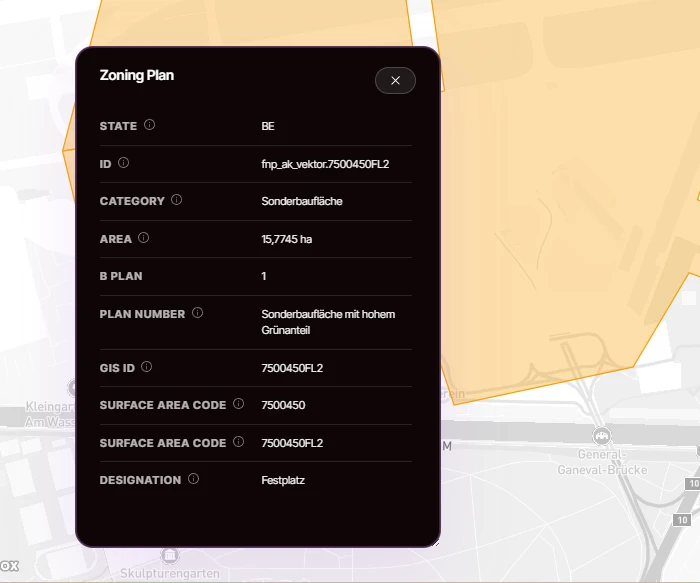
Gewerbliche Baufläche, Gemischte Baufläche, Sonderbaufläche, Gemeinbedarfsfläche, Grünfläche, Landwirtschaftsfläche and more, normalised across municipalities.
Commercial and industrial focus
Areas earmarked for Gewerbe and Industrie are flagged separately, so site scouting can filter straight to them.
Retail concentration
Einzelhandelskonzentration areas, relevant for retail network planning and impact assessments.
Polygon geometry
Geometry per designation, ready for spatial joins against your own sites, catchments or portfolio.
The harmonised categories are what we make comparable across the eight publishing states. On top of them, states and municipalities differ in attribute depth, categorisation detail and geometry resolution. Where a source publishes more, we keep it rather than flattening it away. What you receive follows the publishing authority, not a fixed ceiling on our side.
What is Flächennutzungsplan data used for?
- Early-stage site scouting for industry and logistics: FNP designations flag where municipalities intend commercial development, sometimes years before a binding Bebauungsplan exists.
- Screening a whole region for intended commercial or industrial land before commissioning a feasibility study, so the study starts from a shortlist rather than a blank map.
- Checking whether a site's intended use matches your plans before you invest further. A mismatch at FNP level is a cheap early warning.
- Retail network planning and impact assessments: designated retail-concentration and mixed-use areas become comparable across municipal boundaries instead of staying locked in per-municipality legends.
Where does Flächennutzungsplan data come from?
Official state geoportals and planning services of the eight publishing states. Every polygon keeps a reference back to the publishing authority, so any record can be verified at origin.
Which federal states publish Flächennutzungsplan data?
Flächennutzungsplan data is published at source in 8 of 16 federal states: Baden-Württemberg, Berlin, Brandenburg, Hamburg, Mecklenburg-Vorpommern, Lower Saxony, Schleswig-Holstein and Thuringia. Where the state publishes it, we carry it. For the other eight, we state plainly that the source does not.
Coverage by federal state
- BBBrandenburgAvailable
- BEBerlinAvailable
- BWBaden-WürttembergAvailable
- BYBavariaNot published by the state
- HBBremenNot published by the state
- HEHesseNot published by the state
- HHHamburgAvailable
- MVMecklenburg-Western PomeraniaAvailable
- NILower SaxonyAvailable
- NWNorth Rhine-WestphaliaNot published by the state
- RPRhineland-PalatinateNot published by the state
- SHSchleswig-HolsteinAvailable
- SLSaarlandNot published by the state
- SNSaxonyNot published by the state
- STSaxony-AnhaltNot published by the state
- THThuringiaAvailable
Where the federal state publishes this layer, we carry it: 8 of 16 federal states today. Where it doesn't, we say so.
Coverage gap
Your region of interest isn't covered?
Coverage follows what each state and municipality has actually digitised, so there are real gaps, and they are not always where you would expect. Tell us the region and the layer you need and we will look into what can be sourced for it, including data we do not list today.
Tell us what you needHow do you get Flächennutzungsplan data?
One unified dataset: Ready for direct integration into your GIS, CAD, or BI tools. Standard formats, documented schema.
Mapular Explorer: Instant planning interface, no GIS setup required. Filter, analyse, and export from your browser.
Frequently asked questions about Flächennutzungsplan data
What is the difference between a Flächennutzungsplan and a Bebauungsplan?
The Flächennutzungsplan (FNP) covers the whole municipality and states intended use at a coarse level; it binds public authorities, not individual builders. The Bebauungsplan (B-Plan) is legally binding for a specific area and defines what may actually be built. The FNP tells you the direction of travel, the B-Plan tells you the rules.
Is the Flächennutzungsplan legally binding for my project?
No. The FNP is a preparatory plan under §5 BauGB that binds public authorities in their own planning (§7 BauGB). Building rights follow from a Bebauungsplan or, where none exists, from §34 and §35 BauGB. Use this layer as an early indicator, not as a permit check.
Why is Flächennutzungsplan data only available for 8 of 16 states?
Eight federal states publish Flächennutzungsplan data at source: Baden-Württemberg, Berlin, Brandenburg, Hamburg, Mecklenburg-Vorpommern, Lower Saxony, Schleswig-Holstein and Thuringia. The other eight do not, so we do not carry them as a standing layer. Where the state publishes it, we carry it; where it does not, we say so plainly and source individual plans on request.
Can I combine Flächennutzungsplan data with Bebauungsplan data?
Yes. Both layers share the same geometry model and identifiers, so you can overlay preparatory FNP intent with binding B-Plan rules in your own GIS or analysis stack. That combination is one of the most common uses of the catalog: direction of travel from the FNP, actual rules from the B-Plan.
Can we use Flächennutzungsplan data in a commercial project?
Yes. The underlying records are public planning information, and we deliver them for commercial use including client-facing deliverables. The specific licence terms travel with your agreement, and where a state attaches attribution requirements to its source data, we pass those on to you.
How is this different from downloading the plans myself?
Nothing stops you: the records are public. The difference is that a cross-regional comparison means reconciling different legends, formats and publication practices per municipality, then re-doing that work every time a source changes. We have already done it, and keep doing it, so you query one harmonised layer instead.