Mapular Explorer
Your Browser. Our Harmonised Data.
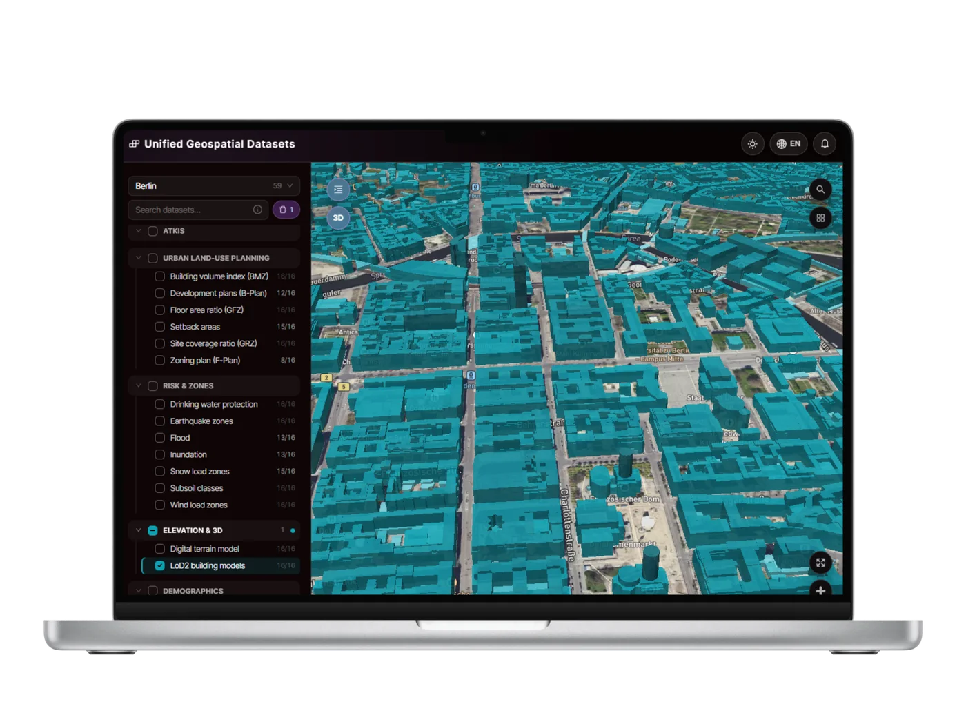
Mapular Explorer is the browser-based way into the same harmonised model that ships through our GIS, CAD and BI-ready delivery: pick a dataset, click a feature, read every attribute, source included.
What You Can Do
Everything the Model Carries, Readable at a Glance
One click, full attributes
Click a Bebauungsplan, a parcel, or a LOD2 building, and every field opens exactly as published, with the source document one click away where one exists.
Search across categories
Type a layer name and the sidebar narrows instantly, ALKIS, ATKIS, planning, risk, elevation and demographics, all in one tree.
Download what you find
A feature, a filtered layer, or a small shortlist exports directly from the browser, no separate download portal, no request form to fill in first.
State and city selection
Recentre on a federal state or a city and see a live count of what's actually available there before you start looking.
Inside the Model
Six Categories, All 16 States
ALKIS
Cadastral parcels and buildings from Germany's official real-estate cadastre.
ATKIS
Topographic base data: transport, water bodies, vegetation, land-use areas.
Urban Land-Use Planning
Bebauungspläne, Flächennutzungspläne, and GRZ, GFZ and BMZ as reference values.
Risk & Zones
Flood, earthquake, snow load, wind load, subsoil and drinking-water protection.
Elevation & 3D
The digital terrain model and LOD2 3D building models.
Demographics
National population and labour-market indicators, same model as the spatial layers.
Beyond Browsing
Know the Workflow? We Build the Filter.
Explorer answers one question at a time out of the box: search, click, read the attributes. For a screening rule your team runs often, undeveloped parcels above a size threshold, near enough population, where a Bebauungsplan or Flächennutzungsplan actually permits the use, that's more than a filter parameter can express.
Mapular's custom development enriches the model and builds that filter logic directly into Explorer, so the check becomes a saved view your team reuses instead of a manual walk-through repeated by hand.
Development Plan
Legally Binding Area
Development Type
Area (ha)
0.0 – 1784.6 ha
Building Coverage
0% – 15%
One Model, Two Doors
Explorer for Looking, Integration for Building
Explorer is built for scouting and spot-checks: a planner checking one parcel, an analyst verifying a hazard class. The moment that question repeats, or needs to sit inside your own systems alongside your own data, the same schema is ready as a direct integration instead.
See how integration worksFAQ
Common Questions
Is Mapular Explorer free to use?
Explorer ships as part of Mapular's geospatial data packages. Book a demo and we'll set you up with access scoped to the layers and regions you need.
Is the data in Explorer the same as the API data?
Yes. Explorer renders the same harmonised layers documented in the geospatial data catalog, with the same per-state coverage and the same attribute schema, just built for browsing rather than for piping into your own stack.
Can I export what I find in Explorer?
Yes, individual results can be exported for one-off use. For a repeatable export or an automated feed, the GIS, CAD or BI-ready integration or a custom-built workflow is the better fit.
Ready?
See Mapular
in Action.
Book a free 30-minute demo. We'll show you exactly how the platform works for your use case, with no generic slides and no obligation.