Das Wichtigste in Kürze:
- Ein Flurstück ist die kleinste Einheit der Grundstücksregistrierung in Deutschland, die Einheit, an der ein Deal, eine Genehmigung oder ein Pachtvertrag tatsächlich hängt
- ALKIS (Amtliches Liegenschaftskatasterinformationssystem), das amtliche Liegenschaftskataster Deutschlands, wird von den Vermessungsverwaltungen der Länder geführt und bundesweit von der AdV, der Arbeitsgemeinschaft der Vermessungsverwaltungen, standardisiert
- ALKIS führt Geometrie, Kennzeichen und Fläche; das Eigentum steht im Grundbuch, einem eigenen Register, das auf Flurstücken aufbaut, aber nicht Teil von ALKIS selbst ist
- Flurstücksgeometrie ist das, was Bauplanungs-, Gefahren- und Portfoliodaten überhaupt erst verknüpfbar macht: Eine Region lässt sich nicht erwerben, ein Flurstück lässt sich shortlisten, prüfen und gegenüber einer Behörde referenzieren
- Die Veröffentlichung erfolgt Land für Land, weshalb die meisten Teams Flurstücke noch immer Einzelfall für Einzelfall auflösen, statt mit ihnen als Daten zu screenen; Bayern veröffentlicht seine ALKIS-Flurstücksdaten an der Quelle gar nicht, weshalb es außerhalb einer harmonisierten Ebene für 15 von 16 Ländern liegt
Shortlists bestehen aus Flurstücken, nicht aus Suchpolygonen. Ein gezogener Radius oder eine grob markierte Fläche ist ein guter Startpunkt für eine Suche, aber sobald diese Suche konkret wird, landet jede Frage, die wirklich zählt, ob Sie hier bauen dürfen, ob eine Überflutungsgefahr besteht, ob ein Einzugsgebiet eines Wettbewerbers berührt wird, wen Sie ansprechen müssen, auf einem Flurstück, der rechtlichen Grundstückseinheit, auf der das deutsche Kataster aufbaut. Dieser Beitrag erklärt, was ein Flurstück ist, warum ALKIS-Flurstücksdaten sich täuschend schwer im großen Maßstab zusammenführen lassen, und wie die ALKIS-Flurstücke-Ebene diese Einheit zu etwas macht, das Sie abfragen können, statt es hinterherzujagen.
Was ist ein Flurstück, und warum zählt es mehr als eine Region?
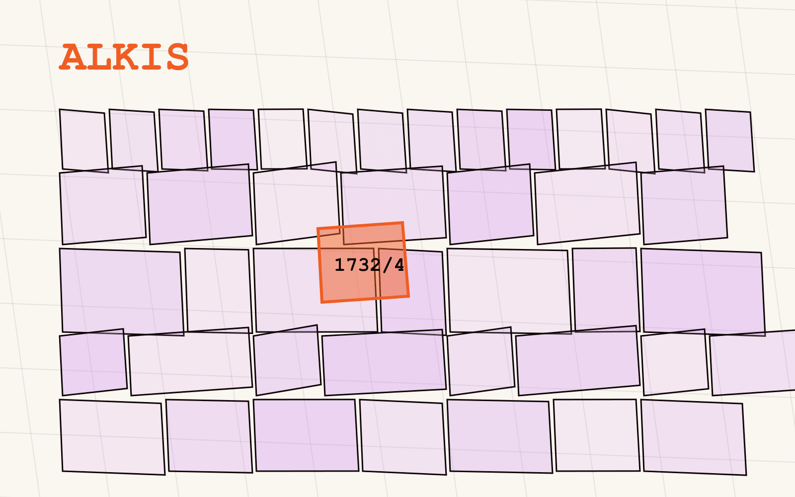
Ein Flurstück ist die kleinste Katastereinheit in Deutschland: eine zusammenhängende Bodenfläche, die im amtlichen Kataster mit einem eigenen, stabilen Kennzeichen geführt wird, zusammengesetzt aus drei Teilen: Gemarkung (dem Katasterbezirk), Flur (einer Unterteilung darin) und Flurstücksnummer (der Nummer des Flurstücks innerhalb dieser Unterteilung). Zusammen ergeben sie das Flurstückskennzeichen, mit dem Behörden, Notare und, wie wir noch sehen werden, das Grundbuch, eindeutig auf ein Stück Boden verweisen.
Regionen, Einzugsgebiete und Radien sind nützlich, um Kandidatenflächen zu finden. Aber gebaut, verpachtet, verkauft oder genehmigt wird nichts gegen eine Region. Gebaut, verpachtet, verkauft oder genehmigt wird gegen ein oder mehrere Flurstücke. Eine Standortsuche, die auf Regionsebene bleibt, betreibt noch Aufklärung; eine Standortsuche, die auf Flurstücke aufgelöst ist, betreibt Due Diligence. Genau in diesem Auflösungsschritt liegt die eigentliche Arbeit, und die eigentliche Reibung.
Was ist ALKIS, und was enthält es wirklich?
ALKIS, das Amtliche Liegenschaftskatasterinformationssystem, ist das amtliche Liegenschaftskataster Deutschlands: die maßgebliche Quelle für Grundstücke, ihre Grenzen und ihre amtliche Fläche. Es wird von der Vermessungsverwaltung jedes Bundeslandes geführt, und sein Datenmodell wird bundesweit von der AdV standardisiert, sodass ein Flurstück in Brandenburg und eines in Baden-Württemberg dieselbe Kernstruktur tragen, auch wenn eine andere Behörde jeweils zuständig ist. ALKIS ist der Nachfolger der älteren Systeme ALB (Automatisiertes Liegenschaftsbuch, das textliche Register) und ALK (Automatisierte Liegenschaftskarte, die Karte), die es in einem einzigen digitalen System zusammengeführt hat.
Was ALKIS praktisch führt, ist Geometrie (die Grenzpolygone jedes Flurstücks, wie im Kataster geführt, nicht nachträglich geschätzt), Kennzeichen (Gemarkung, Flur und Flurstücksnummer, die sich zum Flurstückskennzeichen zusammensetzen) und amtliche Fläche (ein registrierter Wert, keine aus dem Polygon berechnete GIS-Größe). Je nach Bundesland kann außerdem die tatsächliche Nutzung erfasst sein.
Was ALKIS nicht führt, ist Eigentum. Eigentum steht im Grundbuch, einem eigenen Rechtssystem, das sich auf Flurstücke bezieht, aber nicht Teil von ALKIS ist. Diese Unterscheidung ist wichtig für den Umgang mit den Daten: ALKIS sagt Ihnen, was ein Flurstück ist und wo es liegt, nicht, wem es gehört. Für Screening, Bewertung und Planung reicht das in der Regel aus, denn das Flurstückskennzeichen, das Sie damit erhalten, ist genau das, was Sie brauchen, um das Grundstück eindeutig zu referenzieren, sobald Sie auf einen Eigentümer oder eine Behörde zugehen.
Auch bei der Beglaubigung lohnt Präzision. Eine harmonisierte Datenebene liefert eine Datenkopie des Katasterregisters, nützlich für Analysen im großen Maßstab. Wo eine Transaktion oder ein Gericht einen beglaubigten Auszug verlangt, kommt dieser ausschließlich vom zuständigen Katasteramt. Beide dienen unterschiedlichen Zwecken: Der eine erlaubt Screening und Analyse über Hunderte oder Tausende von Standorten, der andere ist das rechtliche Dokument, das ein konkreter Deal braucht.
Warum ist Flurstücksgeometrie der Schlüssel, der andere Daten überhaupt verknüpfbar macht?
Hier liegt der Punkt, der leicht unterschätzt wird: Flurstücksgeometrie ist nicht nur eine weitere Ebene, sie ist der Schlüssel, über den sich jede andere Ebene erst auf Standortebene nutzen lässt. Ein Bebauungsplan sagt Ihnen, was irgendwo gebaut werden darf; eine Hochwassergefahrenebene sagt Ihnen, welches Risiko irgendwo besteht; ein Pachtportfolio sagt Ihnen, was Sie irgendwo bereits halten. Keines dieser "Irgendwos" wird zur Entscheidung, bevor es auf demselben Flurstück verortet ist.
Sobald eine Flurstücksgrenze als saubere Geometrie vorliegt, wird aus jeder anderen Ebene ein räumlicher Join statt einer manuellen Recherche:
- Ein Bauplan gegen Flurstücksgrenzen gelegt ergibt einen Filter: welche Flurstücke vollständig in einem Gewerbegebiet liegen, welche eine Grenze kreuzen, welche außerhalb jeder Planung liegen
- Eine Gefahrenebene übergelegt ergibt ein Screening: welche Flurstücke einer Shortlist eine Überflutungs- oder Altlastenexposition tragen, bevor jemand den Standort besucht
- Eigene Portfolio-, Pacht- oder CRM-Daten übergelegt ergeben eine Karte dessen, was Sie bereits kontrollieren, verknüpft über ein stabiles Kennzeichen statt über einen unscharfen Adressabgleich
Das ist der praktische Grund, warum Flurstücke als Datenebene zählen und nicht nur als juristische Kuriosität. Das Flurstück ist die Geometrie, auf der letztlich jeder andere Datensatz aufsetzen muss.
Warum sind diese Daten deutschlandweit so schwer zu bekommen?
Wenn Flurstücksdaten so nützlich sind, liegt die naheliegende Frage nahe, warum nicht jedes GIS-Team sie längst hat. Die Antwort ist strukturell, nicht technisch.
Jedes der 16 Bundesländer betreibt seine eigene Vermessungsverwaltung, und jede Verwaltung veröffentlicht ihren eigenen Auszug desselben zugrunde liegenden ALKIS-Standards. Die AdV standardisiert das Kernmodell, aber die Veröffentlichung selbst, Formate, Zugangswege, Open-Data-Bedingungen, Lizenzierung, ist eine Länderentscheidung. Manche Länder veröffentlichen saubere Vektor-Geodaten über offene Geoportale; andere binden den Zugang an unterschiedliche Bedingungen, Formate oder Antragswege. Ein bundesweit konsistentes Bild zusammenzuführen bedeutet, mit sechzehn eigenständigen Verwaltungen, sechzehn eigenständigen Veröffentlichungsentscheidungen umzugehen, ohne einen einzigen bundesweiten Schalter, der alles auf einmal freischaltet.
Und dann ist da Bayern. Bayern veröffentlicht seine ALKIS-Flurstücksdaten an der Quelle nicht in einer Form, die sich in eine harmonisierte Ebene übernehmen ließe. Das ist keine Klage über Datenqualität, es ist schlicht der aktuelle Stand der Veröffentlichung in diesem Bundesland. Eine Ebene, die volle bundesweite Abdeckung behauptet und diese Lücke leise umschifft, ist nicht ehrlich darüber, was sie liefert. Eine Ebene, die die Lücke offen benennt, 15 von 16 Bundesländern, Bayern ausgeschlossen, weil es an der Quelle nicht veröffentlicht, sagt genau, was Sie kaufen und was nicht. Diese Ehrlichkeit ist selbst ein Vertrauenssignal: Wenn ein Anbieter offen über das eine Land ist, das er nicht führen kann, können Sie dem vertrauen, was er über die fünfzehn sagt, die er führt.
Was führt die ALKIS-Flurstücke-Ebene tatsächlich?
Die ALKIS-Flurstücke-Ebene von Mapular übernimmt die veröffentlichten Katasterdaten der 15 veröffentlichenden Länder und liefert sie als einen harmonisierten Datensatz, mit demselben Schema auf jeder Ebene. Zu jedem Flurstück:
- Flurstücksgeometrie, die Grenzpolygone wie im Kataster geführt, direkt nutzbar für Verschneidung, Überlagerung und Flächenanalyse in jedem GIS
- Katasterkennzeichen, Gemarkung, Flur und Flurstücksnummer, zusammengeführt zum Flurstückskennzeichen, mit dem Behörden, Notare und das Grundbuch arbeiten
- Amtliche Fläche, der im Kataster geführte registrierte Wert, keine aus der Geometrie geschätzte Zahl
- Tatsächliche Nutzung, wo das Land sie veröffentlicht
Weil ALKIS ein AdV-Standard ist, gilt dieser Kern überall gleich. Was von Land zu Land abweicht, ist, was jenseits dieses Kerns veröffentlicht wird, und Mapular behält, was ein Land veröffentlicht, statt Lücken mit Schätzungen zu füllen. Die Abdeckung ist je Bundesland offen auf der Ebenen-Seite ausgewiesen, genau wie für jeden Datensatz im Geodatenkatalog: Wo ein Land nicht veröffentlicht, wird die Lücke gezeigt, nicht geglättet.
Mit diesem Schema wird aus einem Arbeitsschritt wie "markiere jedes Flurstück in dieser Shortlist, das eine Hochwasserzone überlagert oder außerhalb der benötigten Nutzungsart liegt" keine manuelle Recherche über sechzehn Portale mehr, sondern eine Abfrage mit konsistenter Antwort, über jedes Land hinweg, das veröffentlicht.
Wie geht es weiter?
Wenn Ihr Team Standorte noch immer Katasteramt für Katasteramt oder Geoportal für Geoportal auf Flurstücke auflöst, lohnt ein Blick auf die ALKIS-Flurstücke-Seite: Dort stehen die Attribute, die Abdeckung je Bundesland und die Zugangswege, einschließlich der offenen Aussage dazu, wo Bayern außen vor bleibt. Sie können Beispieldaten anfordern und das Schema gegen Ihren eigenen Workflow prüfen, ob Standortsuche, Due Diligence oder Portfoliokartierung, bevor Sie sich auf irgendetwas festlegen.