Key Takeaways:
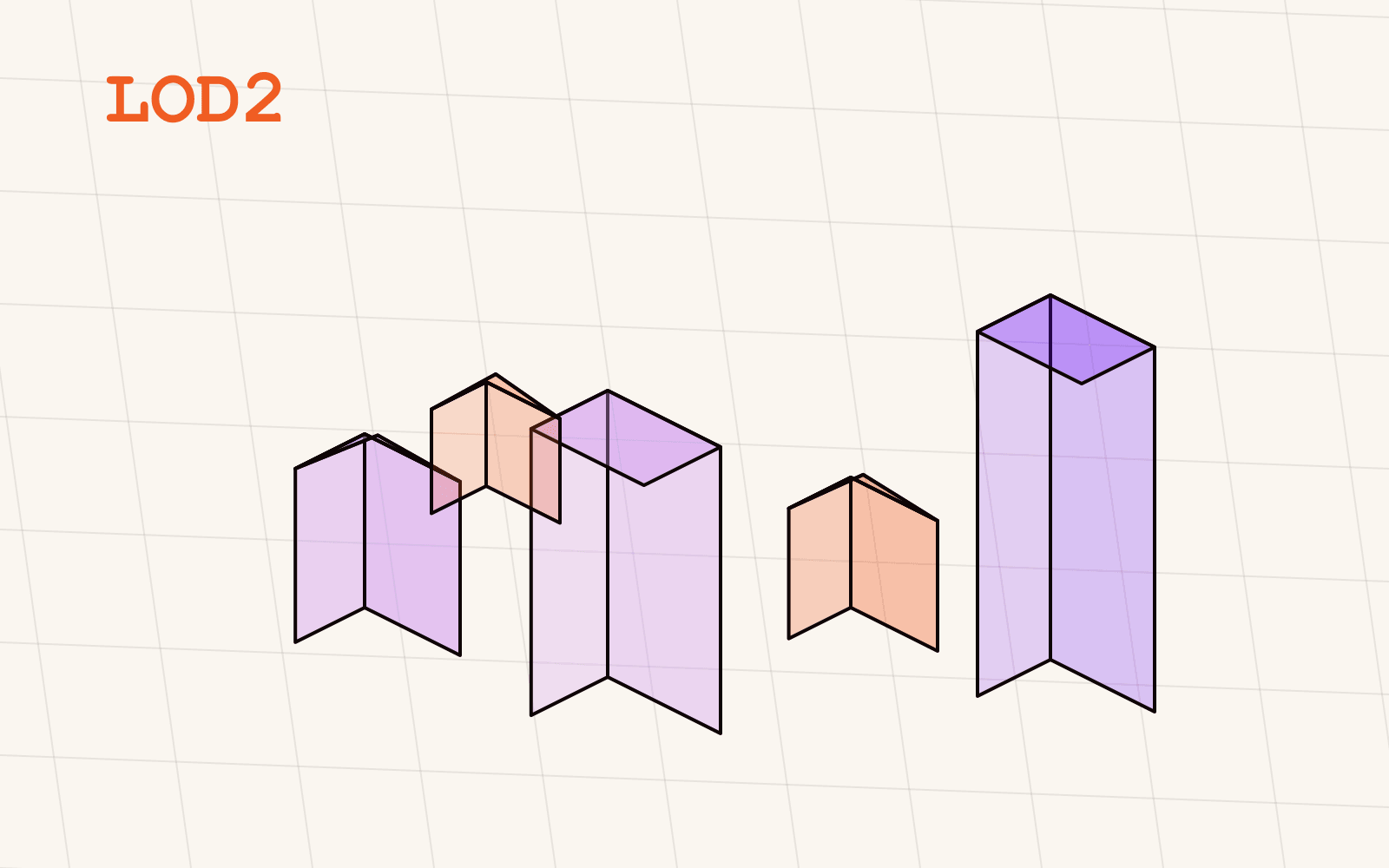
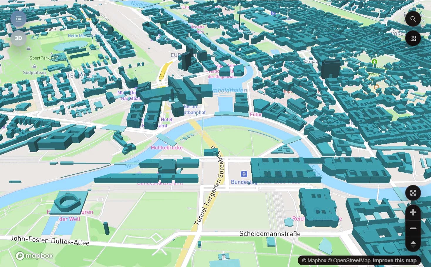
- LOD2-Gebäudemodelle (LOD2 building models) are Germany's official 3D building stock: every building as a solid with its ground footprint, a measured height, and a standardised roof shape
- LOD2 is Level of Detail 2 in the CityGML standard, produced by the state surveying offices from official geodata, not a commercial 3D scan
- LOD1 is a flat-roof block, a footprint extruded to a height with no roof form; LOD3 adds facade detail such as windows and doors, and is not what states publish area-wide
- All 16 federal states publish LOD2, which makes it one of the few official 3D datasets available nationwide, though each state's surveying office produces its own models
- Roof shape and height turn a 2D footprint into something you can honestly compute against: massing, shadow, solar orientation and visibility, at portfolio scale, without commissioning a survey first
If you have ever opened a cadastral footprint and wished it had a third dimension, LOD2-Gebäudemodelle is the answer that already exists. This guide explains what LOD2 actually is, what the CityGML standard specifies, what you can honestly compute from it, and why height attribution changes how a site gets evaluated before anyone drives out to look at it.
What is LOD2?
LOD2 stands for Level of Detail 2, one tier in the CityGML standard for describing 3D city and building models. CityGML defines several levels, and LOD2 is the one built around a specific, deliberate compromise: every building gets a solid ground footprint, a measured height, and a standardised roof shape, gabled, hipped, flat and the other common forms found across German building stock. What it does not get is facade detail. No windows, no doors, no material textures. That level of detail is called LOD3, and it is not what any state publishes area-wide.
The models are produced by the state surveying offices (Landesvermessungen) from official geodata, principally the cadastre and elevation measurements. That production chain is what makes LOD2 the reference 3D building stock of Germany rather than a one-off dataset covering a handful of cities. Wherever a question depends on how tall a building is and which way its roof faces, LOD2 answers it at national scale.
How does LOD2 compare to LOD1 and LOD3?
The three levels sit on a single ladder of detail, and knowing where LOD2 falls on it tells you what to expect before you open a file.
- LOD1: flat-roof block models. A building's footprint extruded straight up to a single height, with no roof shape at all. Useful for a rough massing sketch, not much else.
- LOD2: standardised roof shapes, walls and measured height attribution. This is the layer described in this guide, and the one the state surveying offices publish for the whole country.
- LOD3 and above: detailed facades, windows, doors, sometimes interior structure. This is survey-grade or BIM-grade detail, produced for individual buildings or projects, not published as a nationwide official dataset.
The jump that matters most for practical work is LOD1 to LOD2. A flat-roof block tells you a building occupies a footprint and reaches roughly a certain height. A LOD2 model tells you which way the roof slopes, which is the one attribute solar and shadow analysis actually needs. Going from LOD2 to LOD3 buys you facade realism for visualisation, but for the questions this guide is about (massing, shadow, solar orientation, visibility) it does not change the answer.
Is LOD2 an official survey or a modelled approximation?
Neither, exactly, and the distinction is worth being precise about. LOD2 models are derived by the state surveying offices from official data such as the cadastre and elevation measurements. That gives them clear provenance: authoritative in origin, standardised in form, produced under the same CityGML structure everywhere in the country. What they are not is a certified survey of any individual building, the kind an architect would commission before finalising construction drawings.
For portfolio-scale work that is exactly the right level of confidence. Roof shapes and heights are consistent enough to compare across a whole city or an entire federal state, and the provenance is something you can cite when a finding needs to hold up in a planning conversation. What LOD2 will not give you is construction-ready certainty about a single roof. If a project depends on the exact pitch and area of one specific roof for fabrication or structural design, that still calls for an on-site survey. LOD2 is the layer that tells you, honestly and at scale, where that survey is worth commissioning in the first place.
Why does height attribution matter for site work?
A 2D footprint answers where a building is. It does not answer what you can see from it, what falls in its shadow, or how much usable roof area faces south. Those are all questions about volume and orientation, and a flat polygon has neither. The moment a footprint gets a measured height and a roof shape, it becomes a solid you can actually compute against.
That unlocks a specific set of analyses that are otherwise expensive or impossible to run at scale:
- Massing studies: seeing how a proposed building sits against its neighbours in three dimensions, not just in plan
- Shadow studies: modelling what a new structure, or the existing stock, casts across a site through the day and across seasons
- Solar potential: reading roof orientation and area off the standardised roof shapes to screen where photovoltaic installation makes sense before a site visit
- Visibility analysis: working out what a given vantage point can actually see once surrounding buildings are treated as volumes rather than footprints
- Building stock analysis: comparing height, roof form and function class across a district or a whole portfolio in one query
None of this needs a bespoke 3D scan commissioned for the project. It needs a dataset that already carries height and roof shape as attributes, for every building in the area, at once. That is the practical case for 3D building models as a layer rather than a one-off deliverable: the same schema works whether the area of interest is one parcel or a few hundred.
What attributes does an LOD2 dataset actually carry?
The value of LOD2 is less about the 3D geometry alone and more about what gets attached to each building as data. A usable LOD2 dataset carries:
- Roof shape: the standardised CityGML roof form (flat, gabled, hipped and more), the attribute solar and shadow studies start from
- Building height: the measured height, turning a 2D footprint into a model you can compute visibility and shading against
- Ground footprint: the building's ground surface geometry, consistent with the official building stock it derives from
- Function class: the building's function classification, separating residential, commercial and public stock in one filter
Query these four attributes together and "flat roofs above 400 square metres with southern exposure in this district" becomes a filter, not a manual survey of aerial imagery.
Do all 16 federal states publish LOD2?
Yes, and this is one of the reasons LOD2 is worth building a workflow around rather than treating as a regional curiosity. All 16 states, Bavaria included, publish LOD2 building models, which puts it among the small number of official 3D datasets available on a fully national basis. Most German geodata is fragmented by state, published on different schedules, in different formats, through different portals. LOD2 clears that bar everywhere.
The catch is that each state surveying office produces its own models independently, so acquisition vintage and modelling detail vary from state to state, even though the CityGML structure underneath is the same everywhere. Mapular harmonises the per-state extracts into a single national schema and states the differences openly rather than smoothing them away, so a query run against one state behaves the same way when it is run against all sixteen.
How does LOD2 compare to OpenStreetMap building footprints?
If your current workflow leans on OpenStreetMap (OSM) for building outlines, the comparison is straightforward. OSM building coverage is community-contributed: strong in some cities, thin or outdated elsewhere, and height or roof shape attributes are present only where a volunteer happened to add them. LOD2 is the opposite by construction: official, standardised, and complete with height and roof shape across the whole country, because it comes from the state surveying offices rather than from individual contributions. For a one-off lookup on a single well-mapped building, OSM might be enough. For anything that needs to hold up across a portfolio or a whole state, LOD2 is the dataset built for that.
Where does this fit in a wider data strategy?
LOD2 rarely stands alone. Massing and shadow studies want it alongside cadastral parcels; solar screening wants it alongside irradiance data; planning work wants it alongside zoning layers such as Bebauungspläne. Mapular treats LOD2-Gebäudemodelle as one entry in a broader catalog of harmonised German geodata, built so the same join keys and coverage logic apply across layers. You can browse the full set, with exact per-state coverage, in the geospatial data catalog.
Where to go from here
If your team is still commissioning a 3D survey to answer a question that height and roof shape data could already settle, look at the LOD2-Gebäudemodelle layer page: it lists the attributes, the per-state coverage, and the access routes, and you can request sample data to check the schema against your own workflow before committing to anything.