Key Takeaways:
- A Bebauungsplan (B-Plan), Germany's binding zoning plan, is a legally binding municipal statute under §10 BauGB: it defines what may be built on a specific area, at what density, and for which use
- A qualifizierter B-Plan carries the four determinations of §30 (1) BauGB, and a project that complies with them is admissible, provided site servicing (Erschließung) is secured
- An einfacher B-Plan settles less: whatever it leaves open is judged under §34 BauGB inside built-up areas or §35 BauGB outside them
- Where no plan exists at all, those same fallback rules decide, and the answer gets harder to predict
- B-Plans are published municipality by municipality, often as scanned PDFs behind state portals, which is why most teams still check them one site at a time instead of screening with them
If you evaluate German sites for a living, the Bebauungsplan layer is the one that answers the question everything else circles around: may you build what you intend to build? This guide explains how to read a B-Plan, what the qualifiziert/einfach distinction changes, and what it takes to use plans as screening data rather than as documents you open one by one.
What is a Bebauungsplan?
A Bebauungsplan is Germany's binding zoning plan, the enforceable tier of its land-use planning. Municipalities adopt it as a local statute (Satzung) under §10 BauGB, which means its determinations are law for the area it covers, not guidance.
It sits below the Flächennutzungsplan (the preparatory land use plan covering a whole municipality) and above the individual building permit. The Flächennutzungsplan says where the municipality intends housing, commerce, or industry to go; the Bebauungsplan turns that intention into enforceable rules for specific parcels; the building permit then checks a concrete project against those rules.
The rules themselves are called Festsetzungen, determinations made under §9 BauGB, and their vocabulary comes from the BauNVO (the federal land use ordinance). The ones that matter most for a site decision:
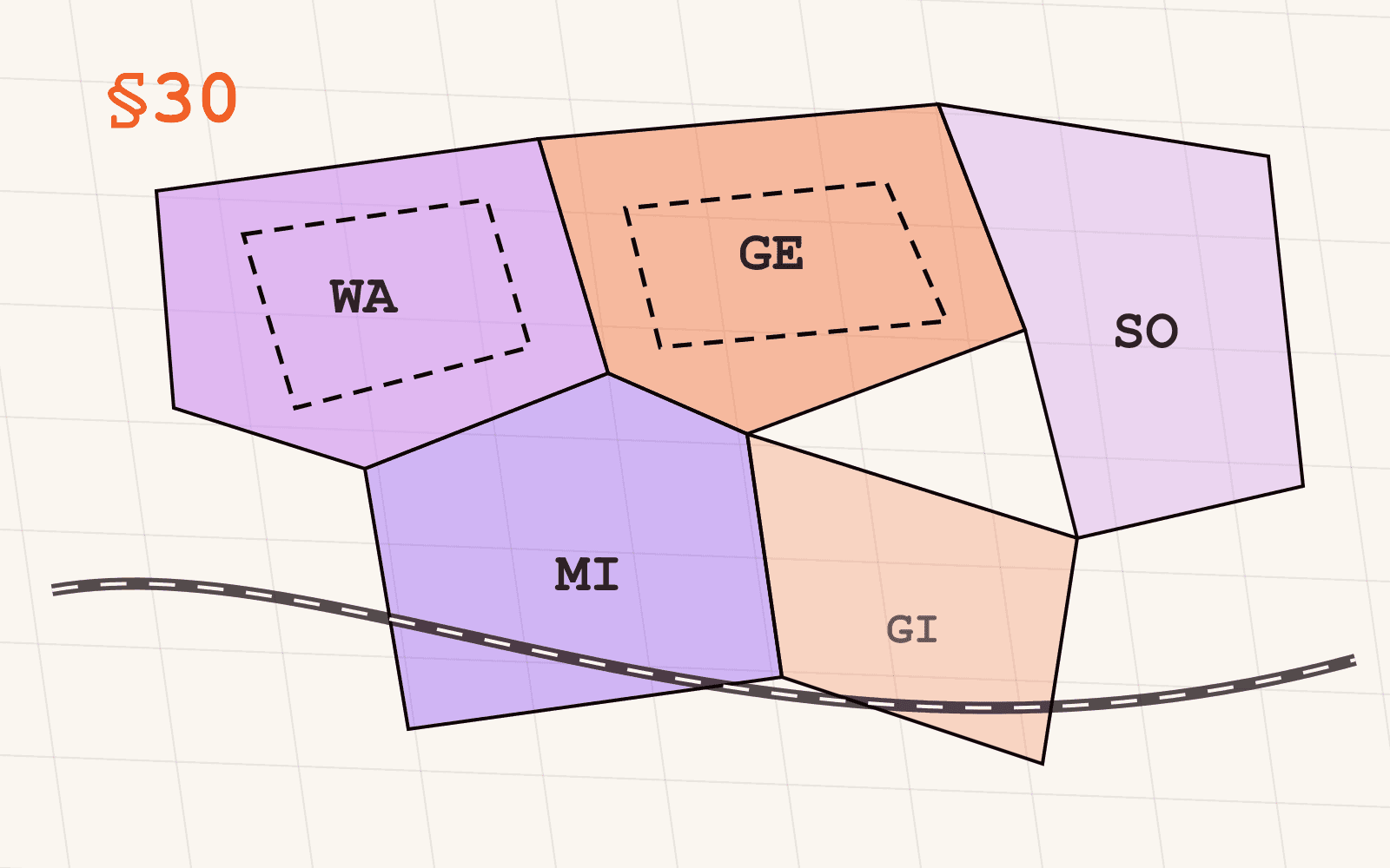
- Art der baulichen Nutzung: the permitted use category, such as Allgemeines Wohngebiet (WA), Mischgebiet (MI), Gewerbegebiet (GE), Industriegebiet (GI), or Sondergebiet (SO)
- Maß der baulichen Nutzung: how much may be built, expressed through values like the site coverage ratio (GRZ), floor area ratio (GFZ), building mass ratio (BMZ), and permitted heights or storeys
- Überbaubare Grundstücksflächen: where on the parcel building is allowed, drawn as building lines (Baulinien) and building limits (Baugrenzen)
- Örtliche Verkehrsflächen: the local road and access layout
What does "qualifiziert" actually mean?
§30 (1) BauGB gives a plan the qualifiziert label when it contains, at minimum, determinations on all four of the subjects above: the type of use, the extent of use, the buildable area, and the local traffic areas.
The label matters because of what it triggers. Inside a qualifizierter B-Plan, a project is admissible if it complies with the plan's determinations and the site's servicing (Erschließung: access, water, sewage, power) is secured. That is the whole test. The authority does not weigh whether your project "fits the character" of the neighbourhood, because the plan has already settled that question in writing.
For a site decision, this is as close to certainty as German planning law gets. If the plan designates GE and your project is a logistics facility that respects the GRZ, the height limit, and the building limits, you are not negotiating. You are complying.
What does an einfacher Bebauungsplan leave open?
Any binding plan that does not carry all four §30 (1) determinations is an einfacher Bebauungsplan under §30 (3) BauGB. It might fix the use but not the density, or draw building limits without settling the use.
Whatever the plan settles is binding exactly as in the qualified case. But for everything it leaves open, the fallback rules apply:
- Inside a built-up area (Innenbereich), §34 BauGB governs: the project must fit into the character of its immediate surroundings (the Einfügungsgebot). What "fits" means is judged from what already stands there, which makes the answer site-specific and, in contested cases, litigable.
- Outside built-up areas (Außenbereich), §35 BauGB governs, and it is restrictive by design: only privileged projects (agriculture, certain infrastructure and energy uses) are generally admissible, and everything else needs to clear a high bar.
There is also a third variant worth knowing: the vorhabenbezogener Bebauungsplan under §12 BauGB, a project-specific plan negotiated between a municipality and a developer for one concrete scheme. If you see one on a candidate site, its rights are tied to that scheme, not to your project.
The practical consequence: two sites can both "have a B-Plan" and still carry very different levels of certainty. That is why Mapular's Bebauungsplan data carries the plan type as an attribute on every polygon, so a screening query can distinguish settled building rights from partially settled ones before anyone opens a document.
What if there is no Bebauungsplan at all?
Large parts of Germany are not covered by any binding plan, and that is normal: municipalities plan where development pressure demands it. Where no plan exists, §34 and §35 BauGB decide alone, along the same Innenbereich/Außenbereich split described above.
For screening purposes, the absence of a plan is itself a signal. An unplanned site inside a built-up area means your certainty depends on the surroundings; an unplanned site outside one means the starting answer is usually no. Either way, you want to know it before the shortlist stage, not after.
Why is Bebauungsplan data so hard to get?
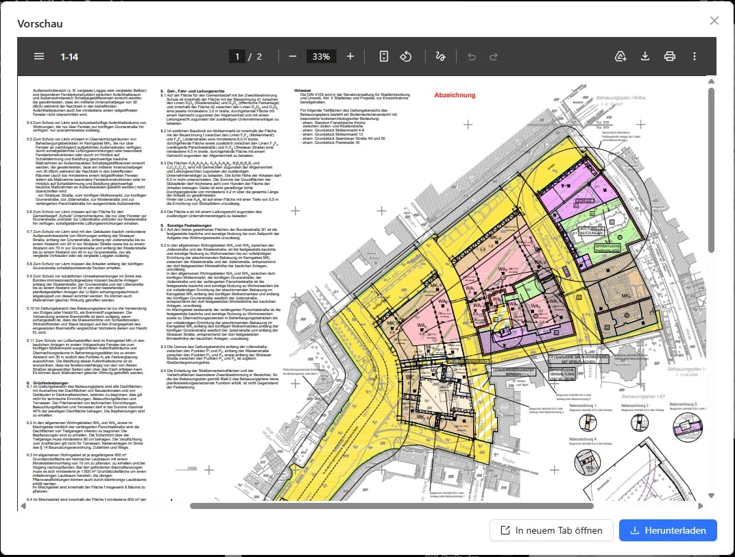
Three structural reasons:
- Plans are municipal. Roughly 11,000 municipalities adopt their own statutes on their own schedules. There is no single national register of B-Plans.
- Publication is uneven. Some states aggregate municipal plans into central portals and geodata services; others leave publication to each municipality. The formats range from proper vector geodata to scanned paper plans behind a viewer. The XPlanung standard is meant to unify the digital format, and adoption is growing, but it is far from universal.
- The document is the legal source. Even where geometry exists as data, the binding content is the adopted plan document with its drawn symbols and written provisions. Any dataset that drops the link to the source document trades away auditability.
This is the fragmentation story in miniature: the data exists, it is public, and it is still genuinely hard to assemble and keep current across state lines.
How do you read Bebauungspläne as data?
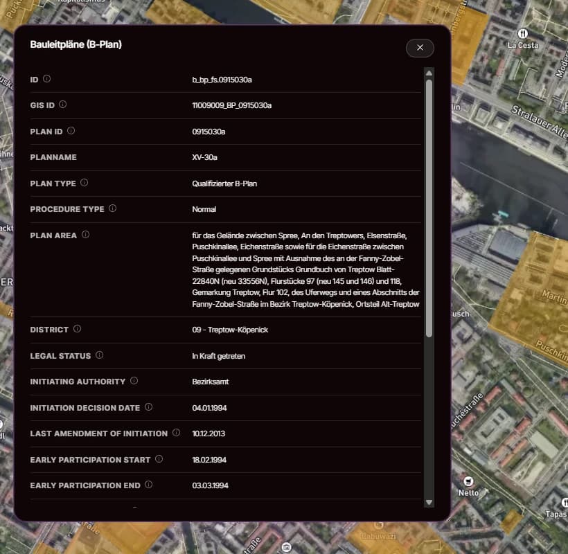
The screening workflow changes when plans stop being PDFs and become a queryable layer. Mapular's harmonised B-Plan layer currently covers the published plans of twelve federal states and carries four attributes on every polygon:
- Plan type, so qualifiziert and simpler variants are distinguishable in a query
- Permitted use (Nutzungsart) as text: Gewerbegebiet, Industriegebiet, Allgemeines Wohngebiet, Sondergebiet and combinations
- A direct link to the source document at the publishing authority, so every finding stays auditable in front of a committee or a lender
- A stable object ID with the polygon geometry, for joins against parcels, portfolios, or catchments
With that in place, "find GE- or GI-designated areas above two hectares within 10 km of the A2" becomes a filter instead of a research project, and every hit still carries the paper trail a lender will ask for. Per-state coverage is stated openly on the layer page, and where a state or municipality has not published, that gap is shown rather than papered over.
The layer ships as part of Mapular's Planning & Building Regulations package, alongside the Flächennutzungspläne and GRZ, GFZ and BMZ as nationwide reference values. You can browse everything we carry, with exact coverage by federal state, in the geospatial data catalog.
Where to go from here
If your team still checks building rights one municipal portal at a time, look at the Bebauungsplan layer page: it lists the attributes, the per-state coverage, and the access routes, and you can request sample data to validate the schema against your own workflow before talking to anyone.